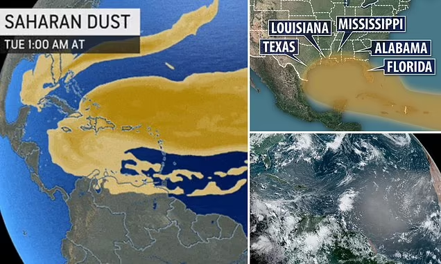
A colossal cloud of dust originating from the Saharan Desert in Africa is currently sweeping its way across the entire Atlantic Ocean. Its course is expected to reach the coasts of Florida and Texas in the next few days, resulting in a shroud of haze over the clear blue skies typically seen in these regions.
According to the latest forecast, the plume is expected to bypass South Florida during the late hours of Friday and early hours of Saturday, before moving towards the Gulf of Mexico over the weekend.
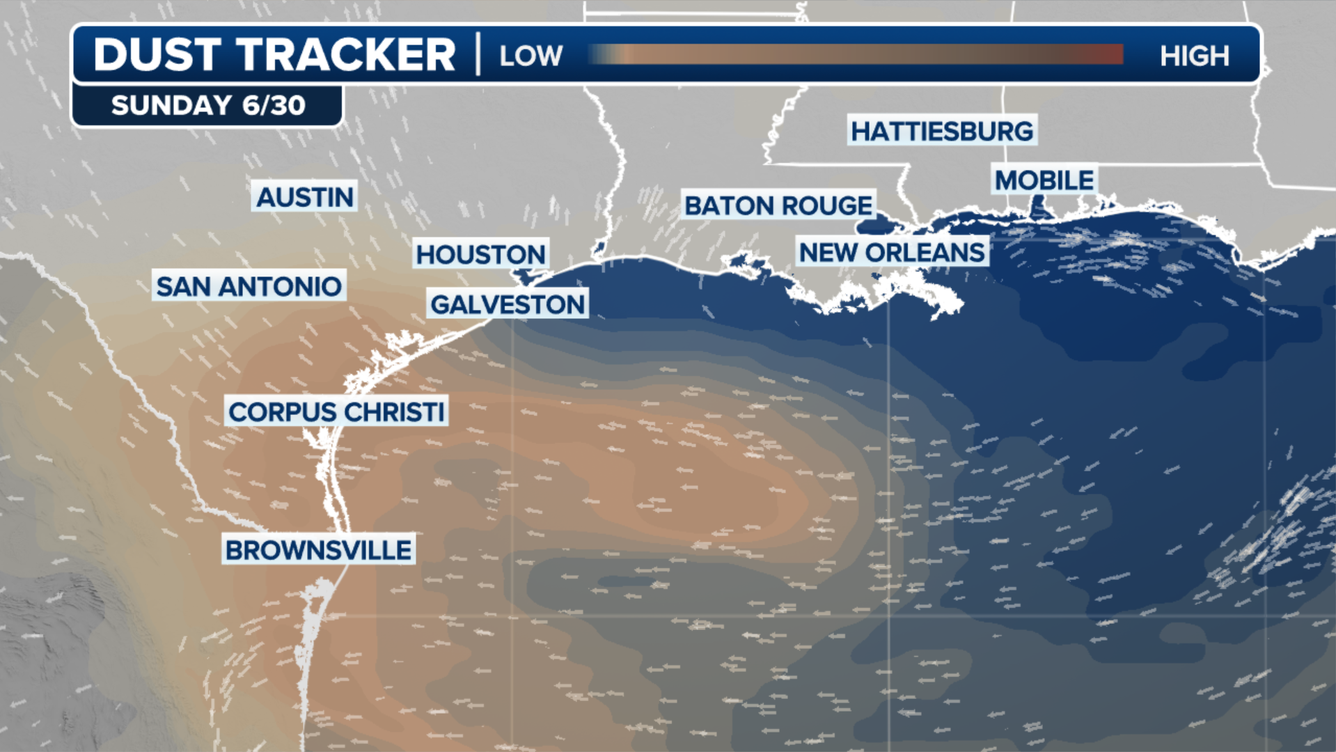
According to the forecast, the plume will make its way towards Southeast Texas on Sunday and Monday, potentially affecting Corpus Christi and even Houston.
During the summer, people living in coastal communities along the Florida Peninsula and the Gulf Coast are no strangers to the sight of Saharan dust plumes. These plumes can affect the air quality, create breathtaking sunrises and sunsets, and decrease the likelihood of rainfall.
182 million tons of dust a year carried away from Africa
The Saharan Desert experiences scorching triple-digit heat on a daily basis, causing dry and hot air to rise from the surface. As a result, fine particles of dust from the sands are carried along with the air, which rises to the highest levels of the atmosphere.
The dust-laden air is then transported by the Easterlies or Trade Winds, blowing from east to west, and travels a distance of about 3,000 miles across the Atlantic Ocean before reaching the Western Hemisphere. This phenomenon is known as the Saharan Air Layer (SAL).
NASA reports that Africa releases approximately 182 million tons of dust annually, although this number may fluctuate based on the precipitation levels in the region south of Sahara.
The plume’s dust concentration has a significant impact on air quality. Individuals with certain respiratory conditions may encounter difficulties due to the increased dust levels. Moreover, those in the plume’s trajectory may experience eye, nose, and throat irritation caused by the fine dust particles present in the air, as reported by WebMD.
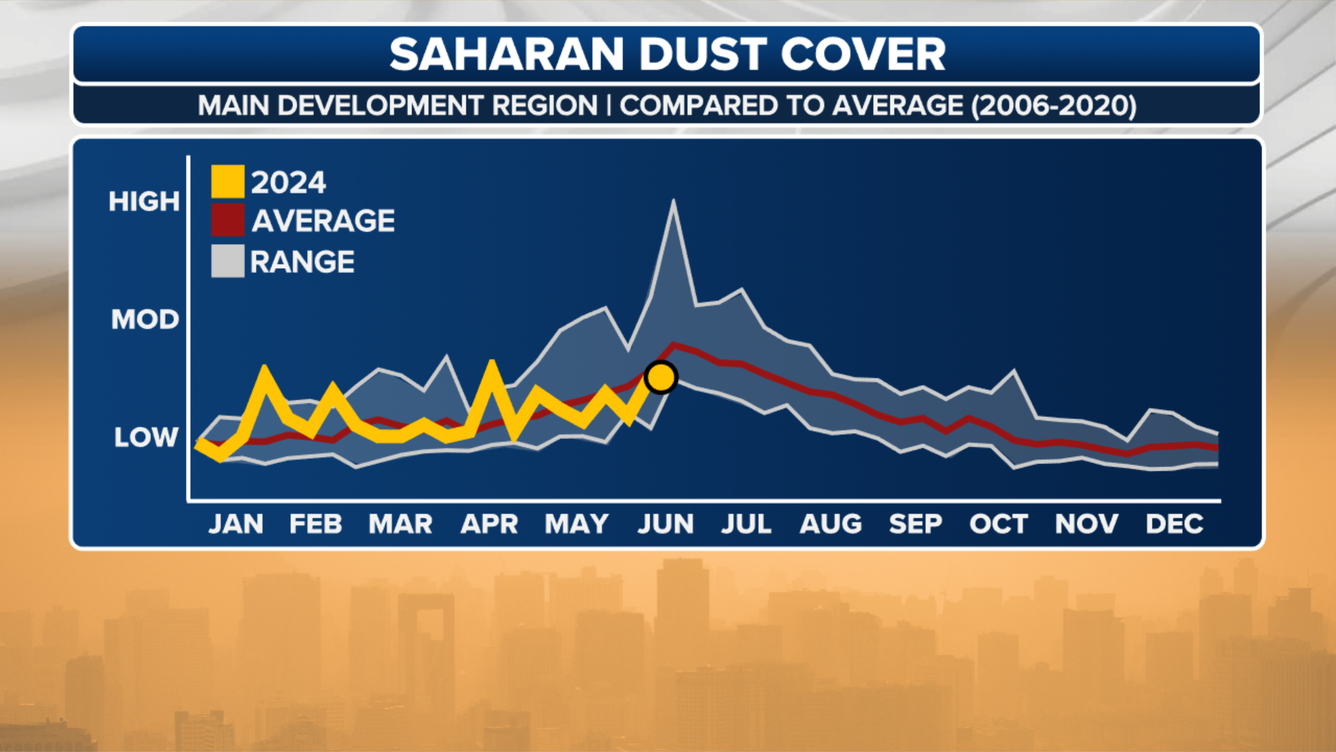
During the initial two and a half months of the hurricane season, the arid air from the scorching, sandy desert serves as a hindrance to the development of tropical storms. The Atlantic experiences frequent occurrences of vast dry air masses along with dust plumes, which act as suppressants for hurricanes.
Despite the presence of a significant amount of dust layer, there is still a notable amount of tropical activity brewing in the Atlantic.
As Invest 95L and a tropical disturbance situated just to its east hover just south of the dust layer, they are utilizing the moisture available to their south to navigate along the periphery of the dust layer while moving towards the west.
Depending on their track, the dust layer could potentially play a significant role in the future development of the storms.


