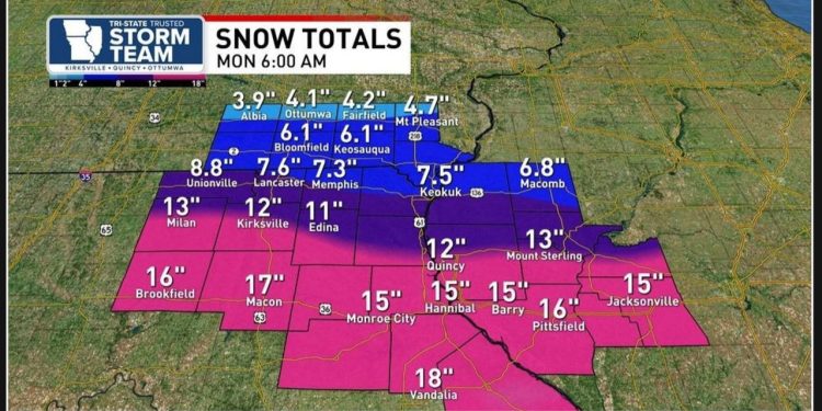
A winter storm is expected to develop in the western region and move towards us, with Kirkville, Missouri and Ottumwa, Iowa being directly affected.
The National Weather Service has issued winter storm watches for all of northern and central Missouri, central Illinois, and extreme southern Iowa in preparation for this upcoming storm.
The central point of this winter storm is projected to move west-to-east just north of the Missouri/Arkansas border, according to various model runs.
The upcoming system is anticipated to develop further south compared to the previous systems that passed through the tristate area. As a result, it will have access to a larger amount of moisture, which increases its potential to generate a heavier snowfall.
According to some model runs, there is a possibility of significant snowfall in certain areas of Missouri and Illinois, with southeast Iowa experiencing less accumulation. Snowfall amounts could potentially reach up to a foot or more in these regions.
Models are predicting significant snowfall in Missouri and Illinois, which could lead to severe travel disruptions, particularly along Highway 36 and Interstate 72.
Travel conditions worsen as you head north of the Missouri/Iowa border on Highway 34. It is strongly advised to limit travel to essential purposes only.
Be sure to complete your grocery shopping or any other errands by Friday or early Saturday morning, as the weather is predicted to worsen rapidly in the afternoon and evening.
Temperatures are predicted to plummet into the low 10’s for daytime highs and hover around zero for overnight lows once this winter storm dissipates.
Please note that the information on snow totals and travel impacts is subject to change within the next 24 to 36 hours. We will keep you updated as soon as we receive any new information.


