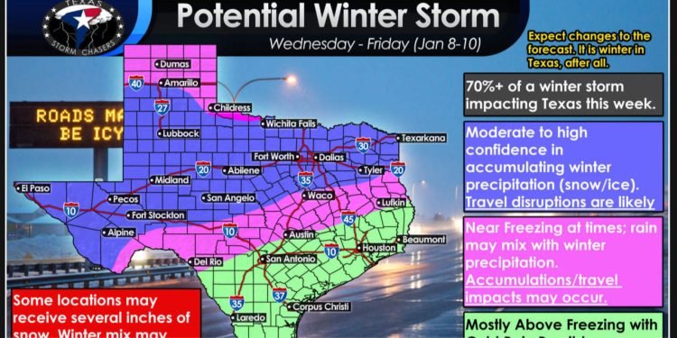
We are feeling more optimistic about a potential winter storm that could begin on Wednesday evening in the west and continue through Thursday, ending by Friday morning in the east. There is a chance of significant snow accumulations and light ice across the northwestern two-thirds of Texas.
The freezing line’s location, the amount of precipitation, and the development of the ‘winter mix’ zone are still uncertain. However, one thing is for certain: a warm-up is expected on Friday and Saturday. Therefore, any snow that falls will not last long. We wanted to inform you in advance about the potential winter storm, as the majority of weather model data (over 70%) suggests that we will experience disruptive winter weather later this week. As we get closer to the dates, there may be some adjustments to the forecast. Rest assured, we will keep you updated.


