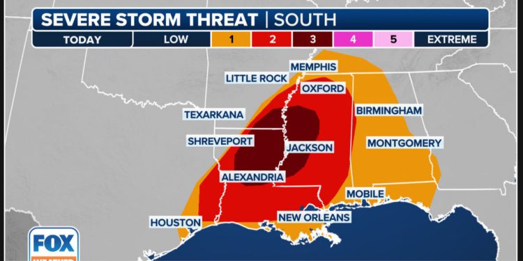
As a coast-to-coast winter storm ripped through the United States on Sunday and Monday, strong thunderstorms erupted over the South on the warm side of the storm.
The severe weather danger began Sunday afternoon and lasted into the night, moving from the Sabine River Valley in East Texas to sections of the mid-South and lower Mississippi Valley.
NOAA’s Storm Prediction Center has issued a tornado watch for far eastern Arkansas, eastern and southeastern Louisiana, and a huge chunk of Mississippi until Sunday night.
The greatest hazards posed by severe storms on Sunday were damaging wind gusts, huge hail, and tornadoes.
The NOAA Storm Prediction Center issued a Level 3 out of 5 risk of severe weather over northern Louisiana, western Mississippi, and southeastern Arkansas, where severe thunderstorms posed the greatest threat. Tornadoes with an EF-2 rating or higher were possible in the region.
Last weekend, a catastrophic tornado outbreak devastated some of these areas, killing at least four people after heavy thunderstorms unleashed dozens of tornadoes across at least seven states.
The violent storms will fade overnight before a new threat emerges further east on Monday.
Sections of Florida and South Georgia are likely to see a few severe thunderstorms with destructive winds and an isolated tornado on Monday, despite the decreased severe weather risk.
Much colder air will arrive in the wake of the coast-to-coast winter storm, putting a stop to the chance of thunderstorms by Monday night.


