A winter storm is expected to move over the eastern United States, bringing snow to the Northeast, Ohio Valley, and Appalachians. This means that residents in these areas may need to get their snow shovels ready once again. Additionally, the winter storm will be followed by another round of Arctic air, making it even colder in these regions.
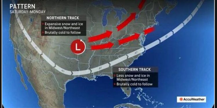
The setup that is causing strong winds in Southern California will also contribute to a storm in the eastern United States this weekend through early next week. The track of the storm will determine the amount of snow, rain, and mixed precipitation it brings.
“How quickly the storm strengthens will help to determine its track,” AccuWeather Chief On-Air Meteorologist Bernie Rayno said. “And consequently, where it tracks will determine where the band of accumulating snow versus rain sets up.”
“A weaker storm is more likely to take a more southern track and will have less cold air to work with. In that case, a minimal amount of snow is likely, but some snow could reach more into the interior Southeast as a result,” Rayno explained. “A stronger storm is more likely to track farther to the north, pull more moisture into the cold air and result in significant snow somewhere from the Midwest to the interior Northeast.”
Areas from the upper Texas coast through the Carolinas, much of Virginia, and the coastal mid-Atlantic region are expected to be impacted by rain. In the Southeast, the rainfall may be accompanied by thunder and lightning, and in some areas, it could be heavy enough to cause localized urban flooding.
From Oklahoma and eastern Kansas to Maine, snow or a wintry mix is the preferred form of precipitation.
In the region spanning from the southern Appalachians to the northern and western suburbs of the Interstate-95 mid-Atlantic cities, the main type of precipitation may consist of either rain or a wintry mix.
A weaker storm in the Midwest and Northeast may result in scattered light snow or flurries. However, there is still a possibility of a wintry mix in the southern Appalachians, Carolinas, Virginia Piedmont areas, and parts of the mid-Atlantic coast. These areas may also be dealing with the aftermath of Hurricane Helene.
The Great Plains will experience the coldest air of the season as it moves southward from later this weekend to early next week. This cold spell will result in snowfall along the Rockies, spanning from Montana to New Mexico, including the Denver area.
Next week, the cold air from the storm will flow eastward, reaching the Southeast, Midwest, and Northeast regions.


