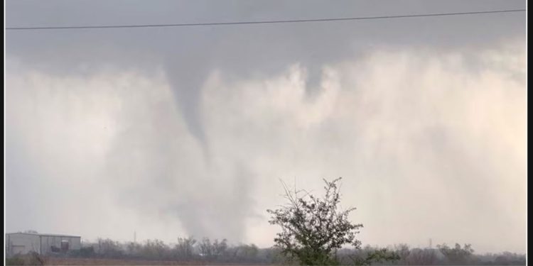
A total of 34 tornadoes were reported across five states – Texas, Louisiana, Arkansas, Mississippi, and Alabama – on Saturday.
According to the mayor of Manvel, Texas, Dan Davis, there has been at least one storm-related death in Texas. Additionally, he mentioned that there has been significant damage to buildings and schools, as well as widespread power outages.
According to Davis, a significant number of individuals to the east of Manvel are currently dealing with the aftermath of power and water outages. In addition to this, trailer homes in the area have been completely destroyed.
According to Governor Tate Reeves, severe weather in Mississippi has tragically resulted in one fatality and two injuries. This unfortunate incident occurred on X Saturday evening.
According to Reeves, the process of evaluating the extent of the damage is currently in progress and will be ongoing throughout the night.
Tornado activity is anticipated to persist this afternoon and evening as a potent severe weather outbreak persists across the Southern region.
The tornado watch in Texas has been classified as a “Particularly Dangerous Situation.” This designation is reserved for tornado watches that the Storm Prediction Center deems to have a high likelihood of multiple intense tornadoes, rated EF2-EF5.
According to the Storm Prediction Center, the designation occurs in only about 7% of tornado watches.
On Saturday, there was a moderate risk for severe weather extending from eastern Texas through Louisiana and Mississippi and into Alabama.
Severe weather risk started in Texas on Saturday morning and then moved eastward throughout the evening and overnight.
The Storm Prediction Center warns that the greatest risk lies in the potential for several strong and large long-tracked tornadoes, which could reach EF3 or greater in intensity.
Large hail, damaging wind, and flash flooding are among the other risk factors to consider.
On Saturday, the southern states from Texas to Alabama and Tennessee are expected to receive a significant amount of rainfall. Weather forecasts predict that an estimated 2 to 4 inches of rain will fall during this time, with some localized areas experiencing even higher amounts of 5 inches or more. As a result, there is a heightened risk of flash floods in these regions.
The severe threat in the Southeast will also be impacted by the same storm complex on Sunday. However, it is anticipated to be less intense compared to Saturday.
Georgia and the Carolinas are expected to experience strong to severe storms during the morning hours. Major hubs like Charlotte and Atlanta may face morning delays as a result of the storm.
On Sunday, the main concern will be the potential for damaging wind and the possibility of tornadoes. However, it should be noted that the threat level is expected to be lower compared to Saturday.
There is a possibility of strong to severe storms occurring in Virginia during the late morning and early afternoon.
The rain is expected to reach Philadelphia and New York City early Monday morning, but it will likely clear out by sunrise. Boston, on the other hand, can expect a rainy Monday morning.


