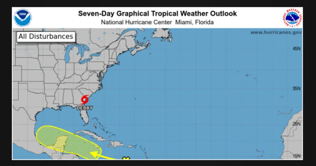
According to the latest National Hurricane Advisory, a tropical wave that originated east of the Windward Islands over the weekend is still generating showers and thunderstorms. However, there have been no significant changes in its development.
On Tuesday morning, the tropical disturbance was on its way to Mexico’s Yucatan Peninsula, which was the location where Hurricane Beryl hit before making landfall in Texas at the beginning of the previous month.
According to the latest advisory, the system’s development is expected to be gradual over the next few days as it moves towards the central Caribbean Sea. However, there is a possibility of favorable environmental conditions for its growth later this week, as it progresses towards the western Caribbean Sea or the southern Gulf of Mexico. It is advised to keep a close eye on any updates regarding this system.
Track the disturbance
This Article Includes
The possibility of the disturbance intensifying into a tropical depression or tropical storm remains uncertain.
There is a low chance of formation, only 10 percent, within the next 48 hours. Looking ahead to the next 7 days, the formation chance remains low at 30 percent.
Hurricane storm tracker: See active storms in the Atlantic
Texas weather watches and warnings
What is a watch vs. warning?
When a warning is issued, it indicates that certain conditions are likely to arise within the designated warning area.
When a watch is issued, it indicates that there is a possibility of certain conditions occurring within the designated watch area. Typically, it is released at least 48 hours before the expected onset of tropical-storm-force winds, which can make outdoor preparations challenging or hazardous.
Read More:
- Federal judge rules that Ohio school district can punish students for misgendering classmates
- Feds order Ohio physician to pay $4.7M for issuing illegal opioid prescriptions
