
Temperatures soared into the triple digits in some parts of the region this afternoon, including in Tallahassee. While scattered storm coverage across the Big Bend has cooled off some localized areas this evening, South Georgia has remained relatively dry. However, the majority of the region is still experiencing temperatures in the 90s just a few hours before sunset. As we head into the night, clear skies should be expected with temperatures dropping through the 80s and settling in the mid to upper 70s by sunrise tomorrow morning.
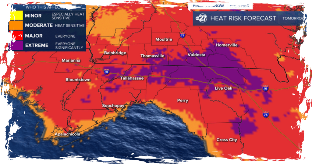
On Monday, the day will begin with a higher amount of clouds than sun in most areas. However, by 9 am, the skies will transition to mostly sunny, and temperatures will rise through the 80s. For the early part of the afternoon, the skies will remain mostly sunny until a line of storms moves into the area from the north. Although this will prevent most of the area from reaching 100 degrees, temperatures will still peak in the mid to upper 90s. Due to the triple-digit heat indices, it is crucial to take breaks while spending long periods outdoors and stay hydrated.
Expect hot temperatures and scattered storms on Tuesday, as highs reach near triple digits once again. Wednesday presents the most significant chance of rain this week, with widely scattered showers and storms. On Thursday, expect scattered storms and increased cloud cover. Throughout the weekend, storm coverage will remain scattered in the afternoons with high temperatures ranging from the mid to upper 90s. Overnight lows will remain warm in the mid to upper 70s, with a significant amount of humidity. As it is June, these conditions are to be expected.
Read More:
- Man from Harrisburg receives 19-year sentence for robbing multiple locations across 4 states
- Appeals court vacates Julie Chrisley’s sentence on fraud allegations