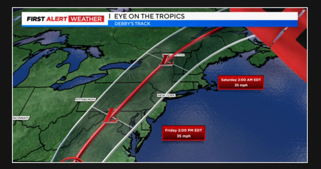
Residents of New York, New Jersey, Connecticut, and Long Island can finally take a breather in the aftermath of the heavy storms that occurred on Tuesday. However, their respite will be short-lived as the next potential threat, Debby, is just around the corner.
On Wednesday, expect showers to occur in and around the city and south. However, there is a chance that some of the northern suburbs might stay dry, at least until the afternoon. Apart from this, the day will be much cooler than usual, with temperatures struggling to reach the low 70s, which is normal for late September.
It’s a good idea to keep your umbrella close at hand on Wednesday night as conditions could remain somewhat unstable. While most of the showers should be easy to handle, there is a chance of encountering a few moderate pockets of rain.
Expect scattered showers, a persistent cloud cover, and a gusty breeze for Thursday. It’s advisable to keep your umbrella close by, but you may not need it all day.
Debby’s storm track
As Debby moves towards the west, the main concern is the location where the heavy rainfall will occur. Will it be over our area or farther inland? According to the latest trend, the heaviest downpour is likely to happen north and west of the city, which is a positive development. However, it’s crucial to keep a close eye on the situation in the upcoming days.
Debby’s track will determine the strength of the winds, which is another worry. At the moment, forecasts suggest that we may experience peak wind gusts of about 45 mph or slightly higher. If the models are accurate, it’s possible that we may witness some weak-rooted trees or downed tree branches.
At the moment, there is no significant coastal flooding expected.
As Debby approaches, officials are urging residents to take the necessary precautions and prepare for the impact. In Lido Beach, Hempstead, N.Y., locals were spotted securing their boats in anticipation of the storm’s arrival.
According to Hempstead Town Supervisor Don Clavin, there will be flooding and trees are expected to come down to some degree. He also stated that those who have experienced flooding in low-lying areas in the past should expect it to happen again.
As we move forward, we will further improve the forecast and provide more accurate information as the situation unfolds. For now, it is advisable to take necessary precautions and stay protected from the rain.
