
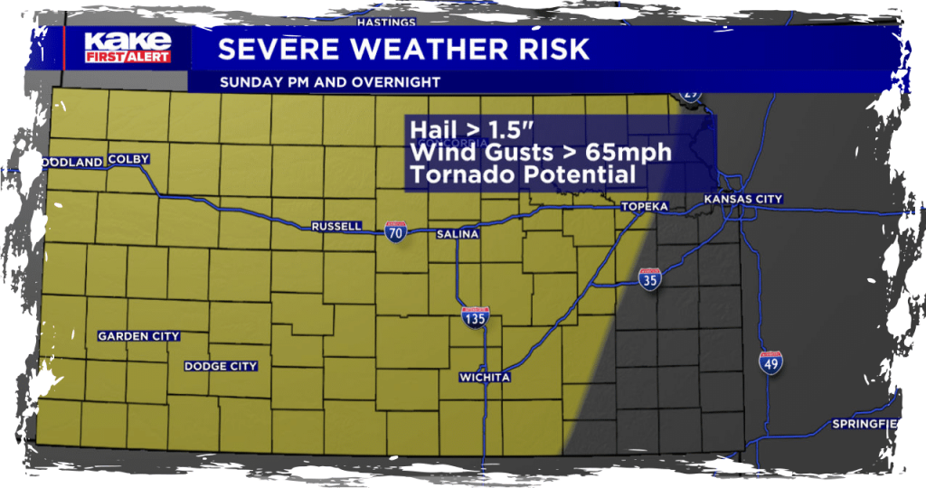
Most of your Sunday is going to be beautiful! The clouds will gradually decrease, and temperatures will warm up into the 80s and 90s today. However, things will quickly change this evening as storms start to develop in western Kansas. The strongest storms are expected in western Kansas, with large hail and strong winds being the main threats. While the possibility of a few tornadoes cannot be ruled out, they are most likely to occur in northwest Kansas.
Get ready for storms kicking off between 4-5 PM in western KS near a dry line front. They’ll start as isolated occurrences, gradually morphing into a line. Expect the most significant hail and strongest wind gusts in western KS. While widespread scattered storms aren’t anticipated, a few potent ones are possible. But don’t underestimate these initial storms! They could pack a punch, with hail ranging from 2-3 inches and winds hitting or exceeding 70 mph.
As they progress eastward, they’ll form into a line and reach central KS by 8 PM. While still robust, these storms won’t be as fierce as in western KS. Central KS might face wind gusts topping 65 mph and hail the size of ping pong balls or larger. However, not everyone will experience such intense threats with all the storms.
Stay vigilant about the weather as evening turns into the overnight hours! Ensure your phone is charged, and keep the volume up to catch any weather alerts while you’re asleep tonight.