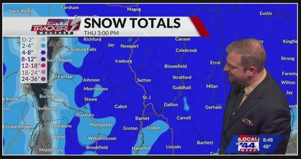
A winter storm, influenced by elevation, will move into the North Country and Upper Valley late Wednesday afternoon and exit Thursday morning. Travel will be most affected Wednesday evening and Thursday morning. The storm will bring a mix of rain and snow to the valleys, with heavy, wet snow expected at higher elevations.
In northern New York, snowfall will range from a light dusting to 2 inches in the St. Lawrence River Valley, stretching from Massena to Oswegatchie. The Adirondacks will see 4 to 8 inches of snow, with the lower end of that range occurring on the mid-slopes and the higher end on the peaks and summits. Areas closer to the Champlain Valley will receive only a light dusting to 2 inches at most.
Northern Vermont, along with central and northern New Hampshire, are likely to see higher snowfall totals. East of the Champlain Valley, totals will quickly increase from a dusting to 2 inches to 4 to 8 inches. The entire Northeast Kingdom, as well as Grafton and Coos counties in New Hampshire, stand a good chance of receiving the higher amounts.
Southern Vermont will experience rain and an icy mix, reducing snowfall totals, even in the mountains. The valleys will receive a trace to 2 inches, but areas along the Route 9 corridor, from Bennington into Windham counties, could see 2 to 4+ inches. Lastly, the Upper Valley will likely receive a sloppy dusting to 2 inches, with mixing also affecting totals there.
